The United States is home to some of the most awe-inspiring rivers in the world, each with its unique charm and characteristics. But which are the widest rivers in the United States? The answer might surprise you! From the Mississippi River to the Colorado River, these waterways are not only impressive in size but also hold historical, cultural, and ecological significance.
Join us as we take a journey through the top 17 widest rivers in the United States, exploring their length, width, depth, and impact on the communities they run through. Get ready for an adventure that will leave you in awe of the natural wonders of our country. Keep reading to discover more!
Table of the widest rivers in the USA
| River Name | Max Width (mi/km) | Length (mi/km) | Max Depth (ft/m) | States it Runs Through |
|---|---|---|---|---|
| Mississippi River | 7 mi / 11.3 km | 2,320 mi / 3,734 km | 200 ft / 61 m | MN, WI, IA, IL, MO, KY, TN, AR, MS, LA |
| Missouri River | 2.6 mi / 4.2 km | 2,341 mi / 3,767 km | 40 ft / 12 m | MT, ND, SD, NE, IA, KS, MO |
| Ohio River | 1 mi / 1.6 km | 981 mi / 1,579 km | 132 ft / 40 m | PA, OH, WV, KY, IN, IL |
| Columbia River | 1.6 mi / 2.6 km | 1,243 mi / 2,000 km | 275 ft / 84 m | WA, OR |
| Colorado River | 0.3 mi / 0.5 km | 1,450 mi / 2,333 km | 85 ft / 26 m | CO, UT, AZ, NV, CA |
| Snake River | 0.6 mi / 1 km | 1,078 mi / 1,735 km | 50 ft / 15 m | WY, ID, OR, WA |
| Susquehanna River | 1 mi / 1.6 km | 444 mi / 715 km | 53 ft / 16 m | NY, PA, MD |
| Red River | 1.5 mi / 2.4 km | 1,360 mi / 2,188 km | 100 ft / 30 m | NM, TX, OK, AR, LA |
| St. Lawrence River | 2.5 mi / 4 km | 744 mi / 1,197 km | 250 ft / 76 m | NY (USA), ON, QC (Canada) |
| Connecticut River | 0.4 mi / 0.64 km | 406 mi / 653 km | 130 ft / 40 m | NH, VT, MA, CT |
| Arkansas River | 1 mi / 1.6 km | 1,469 mi / 2,364 km | 50 ft / 15 m | CO, KS, OK, AR |
| Tennessee River | 1 mi / 1.6 km | 652 mi / 1,049 km | 216 ft / 66 m | TN, KY, AL, MS |
| Platte River | 1.8 mi / 2.9 km | 310 mi / 499 km | 12 ft / 3.7 m | WY, NE, CO |
| Yellowstone River | 1 mi / 1.6 km | 692 mi / 1,114 km | 24 ft / 7.3 m | WY, MT, ND |
| Neuse River | 2 mi / 3.2 km | 275 mi / 443 km | 30 ft / 9.1 m | NC |
See some more official numbers of the Flows of Largest U.S. Rivers—Length, Discharge, and
Drainage Area.
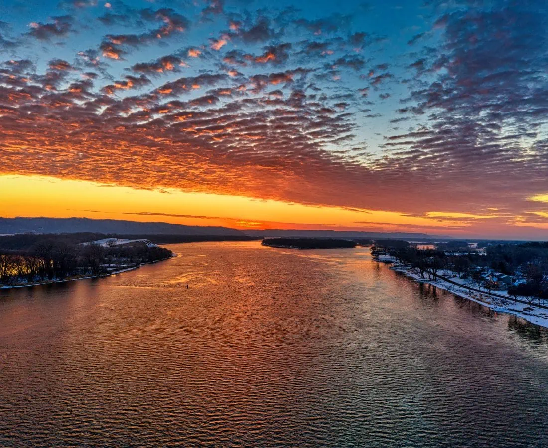
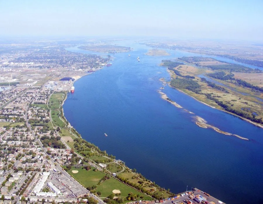
The Mighty Mississippi River
Location and states it runs through
The Mississippi River, North America’s longest and most iconic river, spans over 2,300 miles through 10 states, originating from Lake Itasca in Minnesota and flowing into the Gulf of Mexico.
Source and Mouth
Lake Itasca serves as the river’s source, while its mouth is located in the Gulf of Mexico, where it forms the Birdfoot Delta. Read more about the state with the most lakes in the US.

Top 3 tributaries
The Missouri, Ohio, and Arkansas Rivers are the Mississippi’s three largest tributaries, significantly contributing to its water volume.
Width and Length
The Mississippi River’s width varies greatly, ranging from 20 feet at its headwaters to more than 11 miles at its widest point. Its total length is approximately 2,350 miles.
Biggest depth and cubic meters of water per second
The river reaches its greatest depth of 200 feet near Algiers Point in New Orleans. It discharges an average of 16,800 cubic meters of water per second.
Historical and cultural impact
The Mississippi River has played a crucial role in American history, serving as a transportation hub and fostering economic growth. It has also inspired countless literary, river narratives on film and musical works, shaping the cultural landscape of the United States.
Top 5 geographical facts about the river
- It is the world’s fourth-longest river.
- The Mississippi River watershed drains 31 US states and 2 Canadian provinces.
- Its flow direction changes at the Continental Divide.
- It has formed numerous oxbow lakes due to its meandering course.
- The river has been a critical transportation route for centuries.
Top 5 interesting facts about the river
- Native American tribes have lived along the Mississippi for thousands of years.
- The Mississippi River played a crucial role during the Civil War.
- The Great River Road, a scenic drive, follows the river for 3,000 miles.
- The river is home to over 360 species of fish.
- Mark Twain’s famous novel, “The Adventures of Huckleberry Finn,” is set along the Mississippi River.
The Mesmerizing Missouri River
Location and states it runs through
The Missouri River, the longest river in the United States, stretches approximately 2,341 miles, flowing through seven states: Montana, North Dakota, South Dakota, Nebraska, Iowa, Kansas, and Missouri.
Source and Mouth
The river originates in the Rocky Mountains of Montana at Brower’s Spring and converges with the Mississippi River near St. Louis, Missouri.
Top 3 tributaries
The largest tributaries of the Missouri River are the Yellowstone, Platte, and Kansas Rivers, which significantly contribute to its flow.
Width and Length
The Missouri River’s width varies, averaging between 0.5 and 1.5 miles, while its total length is approximately 2,341 miles.
Biggest depth and cubic meters of water per second
The river’s maximum depth reaches around 40 feet, and it discharges an average of 2,341 cubic meters of water per second.
Historical and cultural impact
The Missouri River holds great historical significance, particularly during the Lewis and Clark Expedition, which opened the American West for exploration and settlement. It has also been a critical transportation route for trade and development.
Top 5 geographical facts about the river
- The Missouri River is the longest river in the United States.
- The river’s watershed encompasses over 500,000 square miles.
- It is a major source of drinking water for several states.
- The river has numerous dams for flood control and power generation.
- The Missouri River has been essential for agricultural irrigation.
Top 5 interesting facts about the river
- The Lewis and Clark Expedition greatly increased knowledge of the river and the American West.
- The Missouri River has experienced significant alterations due to human intervention.
- The river serves as a critical habitat for various endangered species.
- The annual Missouri River 340 race is the world’s longest non-stop river race.
- The Missouri River was once referred to as the “Big Muddy” due to its high sediment load.
The Astounding Ohio River
Location and states it runs through
The Ohio River flows through six states, including Pennsylvania, Ohio, West Virginia, Kentucky, Indiana, and Illinois, stretching over 981 miles.
Source and Mouth
The river’s source is at the confluence of the Allegheny and Monongahela Rivers in Pittsburgh, Pennsylvania. Its mouth is located at the Mississippi River in Cairo, Illinois.
Top 3 tributaries
The Tennessee, Cumberland, and Wabash Rivers are the Ohio River’s three most significant tributaries.
Width and Length
The Ohio River has an average width of 1,300 feet and a total length of 981 miles.
Biggest depth and cubic meters of water per second
The river reaches its deepest point of 132 feet near Louisville, Kentucky. It discharges an average of 7,957 cubic meters of water per second.
Historical and cultural impact
The Ohio River has played a pivotal role in American history as a transportation route and a natural boundary between the North and the South. The Underground Railroad used the river as an escape route for enslaved people seeking freedom in the North.
Top 5 geographical facts about the river
- The Ohio River is the largest tributary of the Mississippi River by volume.
- The river forms the southern boundary of the Midwest.
- The Ohio River Valley has fertile soil, ideal for agriculture.
- The river’s flow is regulated by a series of locks and dams.
- The river has been essential for trade and economic development.
Top 5 interesting facts about the river
- The name “Ohio” originates from the Iroquois word “Ohi-yo,” meaning “great river.”
- The Ohio River was once the western boundary of the United States.
- Steamboats played a crucial role in the river’s transportation history.
- The Ohio River is home to the Green River, a National Wildlife Refuge.
- The river has been a source of inspiration for musicians, such as John Hartford and his song “Gentle on My Mind.”
The Captivating Columbia River
Location and states it runs through
The Columbia River, the largest river in the Pacific Northwest, stretches over 1,243 miles, flowing through the states of Washington and Oregon, as well as the Canadian province of British Columbia.
Source and Mouth
The river originates from Columbia Lake in British Columbia, Canada, and its mouth is located at the Pacific Ocean between Oregon and Washington.
Top 3 tributaries
The Snake, Willamette, and Kootenay Rivers are the Columbia River’s most significant tributaries.
Width and Length
The Columbia River has an average width of 0.5 to 5 miles and a total length of 1,243 miles.

Biggest depth and cubic meters of water per second
The river’s maximum depth is approximately 890 feet at the Wallula Gap, and it discharges an average of 7,500 cubic meters of water per second.
Historical and cultural impact
The Columbia River has played a crucial role in the Pacific Northwest’s history, serving as a transportation route and a source of hydroelectric power. It has also been an essential part of the region’s culture, with several Native American tribes relying on it for sustenance and spiritual practices.
Top 5 geographical facts about the river
- The Columbia River is the fourth-largest river in the United States by volume.
- The river has 14 hydroelectric dams, providing significant amounts of renewable energy.
- The Columbia River Gorge is a National Scenic Area, attracting millions of visitors annually.
- The river forms part of the United States-Canada border.
- The Columbia River Basalt Group is one of the largest flood basalt provinces in the world.
Top 5 interesting facts about the river
- The Columbia River is home to the world’s largest sockeye salmon run.
- The river played a significant role in the Lewis and Clark Expedition.
- The Hanford Site, a former nuclear production complex, is located along the river.
- The Columbia River has been vital for shipping and transportation, connecting the Pacific Northwest to global markets.
- The river’s watershed supports diverse ecosystems, including forests, grasslands, and alpine meadows.
The Enchanting Colorado River
Location and states it runs through
The Colorado River spans over 1,450 miles and flows through seven US states, including Colorado, Wyoming, Utah, New Mexico, Nevada, Arizona, and California, as well as two Mexican states.
Source and Mouth
The river originates in the Rocky Mountains at La Poudre Pass in Colorado, and its mouth is situated at the Gulf of California in Mexico.
Top 3 tributaries
The Green, Gunnison, and San Juan Rivers are the Colorado River’s most significant tributaries.
Width and Length
The Colorado River has an average width of 100 to 300 feet, and its total length is approximately 1,450 miles.
Biggest depth and cubic meters of water per second
The river’s maximum depth is around 85 feet in the Grand Canyon, and it discharges an average of 620 cubic meters of water per second.
Historical and cultural impact
The Colorado River has played a vital role in the development of the American Southwest, providing water for agriculture, urban areas, and recreation. It is also culturally significant, with numerous Native American tribes living along its course.
Top 5 geographical facts about the river
- The Colorado River flows through 11 US National Parks.
- The river carved the iconic Grand Canyon over millions of years.
- The Glen Canyon Dam forms Lake Powell, the second-largest man-made reservoir in the United States.
- The Hoover Dam, situated on the Colorado River, was once the world’s largest dam.
- The river is essential for providing water to over 40 million people in the Southwest.
Top 5 interesting facts about the river
- The Colorado River is nicknamed “The Lifeline of the Southwest.”
- The river’s flow has been so heavily allocated that it rarely reaches its delta in the Gulf of California.
- The Colorado River is home to various endangered species, such as the humpback chub and razorback sucker.
- The river has been the subject of numerous water rights disputes between states and countries.
- The river’s water has been responsible for shaping the unique landscapes of the American Southwest, such as the red rock formations in Arizona and Utah.
The Spectacular Snake River
Location and states it runs through
The Snake River stretches over 1,078 miles and flows through the states of Wyoming, Idaho, Oregon, and Washington.
Source and Mouth
The river’s source is located in Yellowstone National Park at the Two Ocean Plateau, and its mouth is at the confluence with the Columbia River in Washington. (also check how wolves change rivers – about the transformation of the reintroduction of wolves in Yellowstone park)
Top 3 tributaries
The Boise, Salmon, and Clearwater Rivers are the Snake River’s most significant tributaries.
Width and Length
The Snake River’s average width ranges from 100 to 1,000 feet, while its total length is approximately 1,078 miles.
Biggest depth and cubic meters of water per second
The river’s maximum depth reaches around 114 feet near Hells Canyon, and it discharges an average of 1,500 cubic meters of water per second.
Historical and cultural impact
The Snake River has played an essential role in the history of the Pacific Northwest, serving as a transportation route for trade and exploration. It also holds cultural significance for numerous Native American tribes who have lived along its course for centuries.
Top 5 geographical facts about the river
- The Snake River forms the impressive Hells Canyon, the deepest river gorge in North America.
- The river flows through several hydroelectric dams, providing electricity to the region.
- The Snake River Plain is a geological feature created by the Yellowstone hotspot’s movement.
- The river is an important part of the Columbia River Basin, contributing to the region’s water supply.
- The river has a wide range of ecosystems, from high mountain meadows to desert sagebrush.
Top 5 interesting facts about the river
- The Snake River was once a primary route for the Oregon Trail, a historic path for pioneers moving west.
- The river is a popular destination for white-water rafting and other recreational activities.
- The river’s name is derived from the S-shaped hand gesture made by the Shoshone people, who lived along its banks.
- The Snake River supports a diverse range of fish species, including salmon, steelhead, and sturgeon. It’s also featured in our post about top US rivers for fly fishing.
- The river has been the subject of numerous conservation efforts aimed at restoring its ecosystems and protecting native species.
Comparison: The Top 10 widest rivers in the world
| River Name | Widest Point (mi/km) | Country |
|---|---|---|
| Amazon River | 24.8 mi / 40 km | Brazil, Colombia, Peru |
| Paraná River | 11 mi / 18 km | Brazil, Paraguay, Argentina |
| Mississippi River | 7 mi / 11.3 km | United States |
| Congo River | 6.2 mi / 10 km | Democratic Republic of Congo, Republic of Congo |
| Ganges-Brahmaputra River | 6 mi / 9.7 km | India, Bangladesh |
| St. Lawrence River | 5 mi / 8 km | Canada, United States |
| Orinoco River | 5 mi / 8 km | Venezuela, Colombia |
| Niger River | 4.3 mi / 7 km | Guinea, Mali, Niger, Nigeria |
| Danube River | 4.1 mi / 6.6 km | Germany, Austria, Slovakia, Hungary, and others |
| Lena River | 4 mi / 6.4 km | Russia |
The Mesmerizing Susquehanna River
Location and states it runs through
The Susquehanna River flows through three states, including New York, Pennsylvania, and Maryland, covering a distance of 444 miles.
Source and Mouth
The river’s source is situated at Otsego Lake in New York, and its mouth is located at the Chesapeake Bay in Maryland.
Top 3 tributaries
The Chemung, Juniata, and West Branch Susquehanna Rivers are the Susquehanna River’s most significant tributaries.
Width and Length
The Susquehanna River has an average width of 300 to 2,200 feet and a total length of approximately 444 miles.
Biggest depth and cubic meters of water per second
The river’s maximum depth is around 53 feet at its confluence with the Juniata River, and it discharges an average of 1,100 cubic meters of water per second.
Historical and cultural impact
The Susquehanna River has played a crucial role in the history of the Mid-Atlantic region, serving as a transportation route, a source of water, and a vital ecosystem. It also has cultural significance for various Native American tribes who have lived along its banks for thousands of years.
Top 5 geographical facts about the river
- The Susquehanna River is the longest river on the East Coast of the United States.
- The river forms several large lakes and reservoirs, such as Lake Wallenpaupack and Conowingo Reservoir.
- The river’s watershed covers over 27,500 square miles across three states.
- The Susquehanna River contributes approximately 50% of the freshwater inflow into the Chesapeake Bay.
- The river flows through the Appalachian Mountains, shaping the region’s landscape.
Top 5 interesting facts about the river
- The name “Susquehanna” is derived from the Lenape word “Siskëwahane,” which means “Oyster River.”
- The Susquehanna River has played a significant role in the development of the coal and timber industries.
- The river is home to several species of fish, including smallmouth bass, catfish, and American shad.
- The Susquehanna River is famous for its picturesque islands and unique rock formations.
- The river has been the subject of numerous conservation efforts aimed at restoring water quality and protecting native species.
The Remarkable Red River
Location and states it runs through
The Red River flows through New Mexico, Texas, Oklahoma, and Arkansas, covering a distance of approximately 1,360 miles.
Source and Mouth
The river’s source is situated in the Llano Estacado region in New Mexico, and its mouth is located at the Mississippi River in Arkansas.
Top 3 tributaries
The Kiamichi, Little, and Washita Rivers are the Red River’s most significant tributaries.
Width and Length
The Red River has an average width of 200 to 1,000 feet and a total length of approximately 1,360 miles.
Biggest depth and cubic meters of water per second
The river’s maximum depth is around 100 feet near its confluence with the Mississippi River, and it discharges an average of 892 cubic meters of water per second.
Historical and cultural impact
The Red River has played a pivotal role in the history of the South Central United States, serving as a natural boundary, a transportation route, and a vital ecosystem. It also holds cultural significance for several Native American tribes who have lived along its course for centuries.
Top 5 geographical facts about the river
- The Red River forms part of the border between Texas and Oklahoma.
- The river is named for its reddish color, which results from the high concentration of clay particles in the water.
- The river flows through several critical ecosystems, such as wetlands, forests, and grasslands.
- The Red River is part of the Mississippi River Basin, contributing to the region’s water supply.
- The river has been the subject of numerous flood control projects, including the construction of levees and dams.
Top 5 interesting facts about the river
- The Red River is sometimes called the “American Nile” due to its role in shaping the region’s agriculture and settlements.
- The river played a significant role in the development of the cotton industry in the 19th century.
- The Red River has been the site of numerous historic events, including the Red River Campaign during the American Civil War.
- The river is home to several species of fish, such as paddlefish, alligator gar, and blue catfish.
- The Red River is a popular destination for recreation, including boating, fishing, and birdwatching.
The Stunning St. Lawrence River
Location and states it runs through
The St. Lawrence River flows through the provinces of Ontario, Quebec in Canada, and the state of New York in the United States, spanning a distance of about 744 miles.
Source and Mouth
The river’s source is at Lake Ontario, while its mouth is situated in the Gulf of St. Lawrence, which is a part of the Atlantic Ocean.
Top 3 tributaries
The Ottawa, Richelieu, and Saguenay Rivers are the St. Lawrence River’s most significant tributaries.
Width and Length
The St. Lawrence River has an average width of 2 to 3 miles and a total length of approximately 744 miles.
Biggest depth and cubic meters of water per second
The river’s maximum depth is around 250 feet in the Thousand Islands region, and it discharges an average of 12,000 cubic meters of water per second.
Historical and cultural impact
The St. Lawrence River has played a crucial role in the history and development of both Canada and the United States, serving as a primary transportation route for trade, exploration, and settlement. It also holds cultural significance for the Indigenous peoples who have lived along its banks for thousands of years.
Top 5 geographical facts about the river
- The St. Lawrence River connects the Great Lakes to the Atlantic Ocean, making it a vital shipping corridor.
- The river is home to the Thousand Islands, an archipelago of over 1,800 islands.
- The St. Lawrence Seaway, a system of locks and channels, allows large vessels to navigate the river.
- The river forms part of the United States-Canada border.
- The St. Lawrence River’s watershed covers an area of over 500,000 square miles.
Top 5 interesting facts about the river
- The St. Lawrence River is named after the Catholic saint, St. Lawrence, by French explorer Jacques Cartier.
- The river supports a diverse ecosystem, including numerous fish species such as Atlantic salmon, walleye, and American eel.
- The St. Lawrence River is famous for its picturesque landscapes, including fjords, cliffs, and waterfalls.
- The river has been central to the fur trade, the timber industry, and the growth of cities such as Montreal and Quebec City.
- The St. Lawrence River is a popular destination for boating, fishing, and other recreational activities.
The Captivating Connecticut River
Location and states it runs through
The Connecticut River flows through four states, including New Hampshire, Vermont, Massachusetts, and Connecticut, covering a distance of approximately 410 miles.
Source and Mouth
The river’s source is located at the Fourth Connecticut Lake in New Hampshire, and its mouth is at Long Island Sound.
Top 3 tributaries
The Deerfield, White, and Farmington Rivers are the Connecticut River’s most significant tributaries.
Width and Length
The Connecticut River has an average width of 400 to 700 feet and a total length of approximately 410 miles.
Biggest depth and cubic meters of water per second
The river’s maximum depth is around 130 feet in the Connecticut River Valley, and it discharges an average of 600 cubic meters of water per second.
Historical and cultural impact
The Connecticut River has played an essential role in the history and development of New England, serving as a primary transportation route for trade, exploration, and settlement. It also holds cultural significance for the Indigenous peoples who have lived along its banks for thousands of years.
Top 5 geographical facts about the river
- The Connecticut River is the longest river in New England.
- The river forms the border between New Hampshire and Vermont for over 240 miles.
- The Connecticut River Valley is known for its fertile farmland and picturesque landscape.
- The river is part of the Atlantic Ocean watershed, contributing to the region’s water supply.
- The Connecticut River flows through various ecosystems, including forests, wetlands, and estuaries.
Top 5 interesting facts about the river
- The name “Connecticut” is derived from the Algonquian word “Quinnehtukqut,” which means “Long Tidal River.”
- The Connecticut River was an essential transportation route during the Industrial Revolution, supporting the growth of manufacturing towns along its banks.
- The river is home to several fish species, including American shad, striped bass, and Atlantic salmon.
- The Connecticut River has been designated as an American Heritage River, recognizing its cultural, historic, and recreational importance.
- The river is a popular destination for boating, fishing, and birdwatching, with numerous parks and wildlife refuges along its course.
Global Warming impacts very wide rivers in the United States
- Changes in temperature: As the climate warms, water temperatures in rivers also rise. This can lead to changes in the river ecosystems, affecting the distribution and behavior of fish and other aquatic species. Warmer water temperatures may also lead to increased evaporation rates, which can lower water levels in rivers.
- Altered precipitation patterns: Global warming can cause shifts in precipitation patterns, resulting in more frequent and intense storms, as well as prolonged droughts. This can lead to fluctuations in river flow rates and levels, impacting the availability of water for various uses, such as agriculture, drinking water, and hydropower generation.
- Melting glaciers and snowpack: Many wide rivers in the United States have their sources in mountainous areas with glaciers and snowpack. As global temperatures rise, these ice reserves are melting at a faster rate, leading to increased river flow rates in the short term. However, as these ice reserves diminish over time, the long-term water supply for these rivers will be threatened.
- Sea-level rise: Rising sea levels due to global warming can result in saltwater intrusion into the lower reaches of wide rivers, impacting freshwater ecosystems and potentially affecting water quality for downstream communities.
- Increased flood risk: Climate change can lead to more frequent and severe flooding events, especially in regions with wide rivers. These floods can damage infrastructure, displace communities, and result in significant economic and environmental impacts.
- Ecosystem impacts: The combined effects of global warming, such as changes in water temperature, flow rates, and water quality, can lead to shifts in river ecosystems. This may result in the loss of biodiversity, the spread of invasive species, and disruptions in the food web.
Addressing the impacts of global warming on wide rivers in the United States (see the Mississippi) will require a combination of mitigation strategies to reduce greenhouse gas emissions and adaptation measures to help communities and ecosystems cope with the changing conditions.
The Enchanting Arkansas River
Location and states it runs through
The Arkansas River flows through four states, including Colorado, Kansas, Oklahoma, and Arkansas, covering a distance of approximately 1,469 miles.
Source and Mouth
The river’s source is located in the Rocky Mountains in Colorado, and its mouth is at the Mississippi River in Arkansas.
Top 3 tributaries
The Cimarron, Canadian, and Neosho Rivers are the Arkansas River’s most significant tributaries.
Width and Length
The Arkansas River has an average width of 300 to 1,500 feet and a total length of approximately 1,469 miles.
Biggest depth and cubic meters of water per second
The river’s maximum depth is around 65 feet in the Arkansas River Valley, and it discharges an average of 1,100 cubic meters of water per second.
Historical and cultural impact
The Arkansas River has played a crucial role in the history and development of the central United States, serving as a primary transportation route for trade, exploration, and settlement. It also holds cultural significance for several Native American tribes who have lived along its banks for centuries.
Top 5 geographical facts about the river
- The Arkansas River is the sixth-longest river in the United States.
- The river flows through various landscapes, including the Rocky Mountains, the Great Plains, and the Mississippi River Valley.
- The Arkansas River is part of the Mississippi River Basin, contributing to the region’s water supply.
- The river has been the subject of numerous flood control and irrigation projects.
- The Arkansas River supports diverse ecosystems, including forests, wetlands, and grasslands.
Top 5 interesting facts about the river
- The Arkansas River was an essential route for the Santa Fe Trail, a historic path for pioneers moving westward.
- The river has played a significant role in the development of the agricultural and energy industries.
- The Arkansas River is home to several fish species, including sauger, blue catfish, and striped bass.
- The river is a popular destination for white-water rafting, fishing, and other recreational activities.
- The Arkansas River has been the focus of numerous conservation efforts aimed at restoring its water quality and protecting native species.
The Majestic Tennessee River
Location and states it runs through
The Tennessee River flows through three states, including Tennessee, Alabama, and Kentucky, covering a distance of approximately 652 miles.
Source and Mouth
The river’s source is located at the confluence of the Holston and French Broad Rivers in Tennessee, and its mouth is at the Ohio River in Kentucky.
Top 3 tributaries
The Clinch, Hiwassee, and Elk Rivers are the Tennessee River’s most significant tributaries.
Width and Length
The Tennessee River has an average width of 650 to 1,500 feet and a total length of approximately 652 miles.
Biggest depth and cubic meters of water per second
The river’s maximum depth is around 90 feet in the Tennessee River Valley, and it discharges an average of 2,000 cubic meters of water per second.
Historical and cultural impact
The Tennessee River has played a vital role in the history and development of the southeastern United States, serving as a primary transportation route for trade, exploration, and settlement. It also holds cultural significance for several Native American tribes who have lived along its banks for centuries.
Top 5 geographical facts about the river
- The Tennessee River is the largest tributary of the Ohio River.
- The river forms part of the Tennessee-Tombigbee Waterway, a system of locks and canals that connect the Tennessee River to the Gulf of Mexico.
- The Tennessee Valley Authority (TVA) has developed a series of dams and reservoirs along the river for flood control, hydroelectric power, and navigation.
- The river flows through several major cities, including Knoxville, Chattanooga, and Decatur.
- The Tennessee River’s watershed covers an area of over 41,000 square miles.
Top 5 interesting facts about the river
- The name “Tennessee” is derived from the Cherokee word “Tanasi,” which was the name of a Cherokee village along the river’s banks.
- The Tennessee River was an essential transportation route during the Civil War, serving both the Union and Confederate armies.
- The river is home to several fish species, including largemouth bass, crappie, and paddlefish.
- The Tennessee River is a popular destination for boating, fishing, and other recreational activities.
- The river has been the focus of numerous conservation efforts aimed at restoring its water quality and protecting native species.
The Alluring Snake River
Location and states it runs through
The Snake River flows through six states, including Wyoming, Idaho, Oregon, Washington, Nevada, and Utah, covering a distance of approximately 1,078 miles.
Source and Mouth
The river’s source is located at Yellowstone National Park in Wyoming, and its mouth is at the Columbia River in Washington.
Top 3 tributaries
The Salmon, Clearwater, and Boise Rivers are the Snake River’s most significant tributaries.
Width and Length
The Snake River has an average width of 1,000 to 1,500 feet and a total length of approximately 1,078 miles.
Biggest depth and cubic meters of water per second
The river’s maximum depth is around 120 feet in Hells Canyon, and it discharges an average of 1,500 cubic meters of water per second.
Historical and cultural impact
The Snake River has played a crucial role in the history and development of the western United States, serving as a primary transportation route for trade, exploration, and settlement. It also holds cultural significance for several Native American tribes who have lived along its banks for centuries.
Top 5 geographical facts about the river
- The Snake River is the largest tributary of the Columbia River.
- The river flows through Hells Canyon, which is the deepest river gorge in North America.
- The Snake River is part of the Columbia River Basin, contributing to the region’s water supply.
- The river has been the subject of numerous hydroelectric and irrigation projects.
- The Snake River supports diverse ecosystems, including forests, wetlands, and grasslands.
Top 5 interesting facts about the river
- The name “Snake” is derived from the way early European explorers interpreted the Native American sign language gesture for “salmon,” which resembled the movement of a snake.
- The Snake River was an essential transportation route during the westward expansion of the United States, including the Oregon Trail and the California Gold Rush.
- The river is home to several fish species, including Chinook salmon, steelhead trout, and sturgeon.
- The Snake River is a popular destination for white-water rafting, fishing, and other recreational activities.
- The river has been the focus of numerous conservation efforts aimed at restoring its water quality and protecting native species.
The Fascinating Colorado River
Location and states it runs through
The Colorado River flows through seven states, including Colorado, Wyoming, Utah, New Mexico, Nevada, Arizona, and California, covering a distance of approximately 1,450 miles.
Source and Mouth
The river’s source is located in the Rocky Mountains in Colorado, and its mouth is at the Gulf of California in Mexico.
Top 3 tributaries
The Green, Gunnison, and Gila Rivers are the Colorado River’s most significant tributaries.
Width and Length
The Colorado River has an average width of 300 to 2,500 feet and a total length of approximately 1,450 miles.
Biggest depth and cubic meters of water per second
The river’s maximum depth is around 85 feet in the Grand Canyon, and it discharges an average of 1,200 cubic meters of water per second.
Historical and cultural impact
The Colorado River has played a vital role in the history and development of the southwestern United States, serving as a primary transportation route for trade, exploration, and settlement. It also holds cultural significance for several Native American tribes who have lived along its banks for centuries.
Top 5 geographical facts about the river
- The Colorado River is the primary water source for over 40 million people in the southwestern United States and Mexico.
- The river flows through several iconic landscapes, including the Grand Canyon, Glen Canyon, and Hoover Dam.
- The Colorado River is part of the Colorado River Basin, which encompasses an area of over 246,000 square miles.
- The river has been the subject of numerous water management projects, including the construction of dams and reservoirs for flood control, irrigation, and hydroelectric power generation.
- The Colorado River supports diverse ecosystems, including forests, wetlands, and deserts.
Top 5 interesting facts about the river
- The Colorado River was named by Spanish explorers who called it “Río Colorado” due to the reddish color of its waters caused by sediment.
- The river played a critical role in the development of the southwestern United States, including the growth of cities such as Los Angeles, Las Vegas, and Phoenix.
- The Colorado River is home to several fish species, including the endangered humpback chub and the razorback sucker.
- The river is a popular destination for white-water rafting, fishing, and other recreational activities, particularly in the Grand Canyon.
- The Colorado River has been the focus of numerous conservation efforts aimed at restoring its water quality and protecting native species.
The Mesmerizing Platte River
Location and states it runs through
The Platte River flows through three states, including Colorado, Wyoming, and Nebraska, covering a distance of approximately 710 miles.
Source and Mouth
The river’s source is located in the Rocky Mountains in Colorado, where the North and South Platte Rivers converge, and its mouth is at the Missouri River in Nebraska.
Top 3 tributaries
The Loup, Elkhorn, and Shell Creek Rivers are the Platte River’s most significant tributaries.
Width and Length
The Platte River has an average width of 330 to 1,500 feet and a total length of approximately 710 miles.
Biggest depth and cubic meters of water per second
The river’s maximum depth is around 20 feet in the Platte River Valley, and it discharges an average of 250 cubic meters of water per second.
Historical and cultural impact
The Platte River has played a crucial role in the history and development of the Great Plains, serving as a primary transportation route for trade, exploration, and settlement. It also holds cultural significance for several Native American tribes who have lived along its banks for centuries.
Top 5 geographical facts about the river
- The Platte River is a major tributary of the Missouri River.
- The river flows through diverse landscapes, including the Rocky Mountains, the Great Plains, and the Platte River Valley.
- The Platte River is part of the larger Mississippi River Basin, contributing to the region’s water supply.
- The river has been the subject of numerous flood control and irrigation projects.
- The Platte River supports diverse ecosystems, including forests, wetlands, and grasslands.
Top 5 interesting facts about the river
- The Platte River was an essential route for westward expansion in the United States, serving as a primary pathway for the Oregon Trail, the California Gold Rush, and the Pony Express.
- The river has played a significant role in the development of agriculture and the energy industry in the Great Plains.
- The Platte River is home to several fish species, including channel catfish, walleye, and sauger.
- The river is a popular destination for birdwatching, particularly during the annual spring migration of the sandhill crane.
- The Platte River has been the focus of numerous conservation efforts aimed at restoring its water quality and protecting native species.
The Breathtaking Yellowstone River
Location and states it runs through
The Yellowstone River flows through three states, including Wyoming, Montana, and North Dakota, covering a distance of approximately 692 miles.
Source and Mouth
The river’s source is located in Yellowstone National Park in Wyoming, and its mouth is at the Missouri River in North Dakota.
Top 3 tributaries
The Bighorn, Tongue, and Stillwater Rivers are the Yellowstone River’s most significant tributaries.
Width and Length
The Yellowstone River has an average width of 75 to 300 feet and a total length of approximately 692 miles.
Biggest depth and cubic meters of water per second
The river’s maximum depth is around 200 feet in the Grand Canyon of the Yellowstone, and it discharges an average of 265 cubic meters of water per second.
Historical and cultural impact
The Yellowstone River has played a crucial role in the history and development of the western United States, serving as a primary transportation route for trade, exploration, and settlement. It also holds cultural significance for several Native American tribes who have lived along its banks for centuries.
Top 5 geographical facts about the river
- The Yellowstone River is the longest undammed river in the contiguous United States.
- The river flows through diverse landscapes, including Yellowstone National Park, the Absaroka-Beartooth Wilderness, and the Great Plains.
- The Yellowstone River is part of the larger Missouri River Basin, contributing to the region’s water supply.
- The river has been the subject of numerous conservation efforts aimed at protecting its pristine water quality and unique ecosystems.
- The Yellowstone River is home to several fish species, including cutthroat trout, rainbow trout, and brown trout.
Top 5 interesting facts about the river
- The Yellowstone River was named after the yellow-colored rocks found along its banks.
- The river played a significant role in the early days of western exploration and settlement, including the fur trade and the Oregon Trail.
- The Yellowstone River is a popular destination for fly fishing, kayaking, and other recreational activities.
- The river is home to several species of wildlife, including bison, elk, and grizzly bears.
- The Yellowstone River is a primary water source for several communities in the region, including Billings and Miles City.
The Marvelous Neuse River
Location and states it runs through
The Neuse River flows through two states, including North Carolina and Virginia, covering a distance of approximately 275 miles.
Source and Mouth
The river’s source is located in Durham County, North Carolina, and its mouth is at Pamlico Sound in North Carolina.
Top 3 tributaries
The Trent, Little, and Contentnea Creeks are the Neuse River’s most significant tributaries.
Width and Length
The Neuse River has an average width of 300 to 700 feet and a total length of approximately 275 miles.
Biggest depth and cubic meters of water per second
The river’s maximum depth is around 50 feet in the Neuse River Estuary, and it discharges an average of 280 cubic meters of water per second.
Historical and cultural impact
The Neuse River has played a crucial role in the history and development of North Carolina, serving as a primary transportation route for trade, exploration, and settlement. It also holds cultural significance for several Native American tribes who have lived along its banks for centuries.
Top 5 geographical facts about the river
- The Neuse River is the longest river entirely contained within North Carolina.
- The river flows through diverse landscapes, including the Piedmont and Coastal Plain regions.
- The Neuse River is part of the larger Pamlico Sound drainage basin, contributing to the region’s water supply.
- The river has been the subject of numerous conservation efforts aimed at protecting its water quality and unique ecosystems.
- The Neuse River is home to several fish species, including blue catfish, largemouth bass, and striped bass.
Top 5 interesting facts about the river
- The Neuse River was named after the Neusiok Native American tribe that once lived along its banks.
- The river played a significant role in the early days of North Carolina’s history, including the settlement of New Bern and the Civil War.
- The Neuse River is a popular destination for fishing, kayaking, and other recreational activities.
- The river is home to several species of wildlife, including bald eagles, river otters, and alligators.
- The Neuse River is a vital source of drinking water for several communities in the region.
The Majestic Yukon River
Location and states it runs through
The Yukon River flows through two countries, including the United States and Canada, covering a distance of approximately 1,979 miles.
Source and Mouth
The river’s source is located in British Columbia, Canada, and its mouth is at the Bering Sea in Alaska.
Top 3 tributaries
The Porcupine, Tanana, and Pelly Rivers are the Yukon River’s most significant tributaries.
Width and Length
The Yukon River has an average width of 0.3 to 3 miles and a total length of approximately 1,979 miles.
Biggest depth and cubic meters of water per second
The river’s maximum depth is around 300 feet in Lake Laberge, and it discharges an average of 6,400 cubic meters of water per second.
Historical and cultural impact
The Yukon River has played a crucial role in the history and development of Alaska and the Yukon Territory, serving as a primary transportation route for trade, exploration, and settlement. It also holds cultural significance for several indigenous peoples who have lived along its banks for thousands of years.
Top 5 geographical facts about the river
- The Yukon River is the third-longest river in North America, following the Mississippi and Missouri Rivers.
- The river flows through diverse landscapes, including the Rocky Mountains
- The Yukon River is part of the larger Bering Sea drainage basin, contributing to the region’s water supply.
- The river has been the subject of numerous conservation efforts aimed at protecting its water quality and unique ecosystems.
- The Yukon River is home to several fish species, including chinook salmon, chum salmon, and arctic grayling.
Top 5 interesting facts about the river
- The Yukon River was an essential route for early American exploration and settlement, including the Klondike Gold Rush.
- The river played a significant role in the development of Alaska’s economy and infrastructure.
- The Yukon River is a vital resource for several indigenous communities who rely on it for subsistence.
- The river is home to several species of wildlife, including moose, grizzly bears, and bald eagles.
- The Yukon River is a popular destination for white-water rafting, fishing, and other recreational activities.
The Magnificent Rio Grande
Location and states it runs through
The Rio Grande flows through three states, including Colorado, New Mexico, and Texas, covering a distance of approximately 1,900 miles.
Source and Mouth
The river’s source is located in the San Juan Mountains of Colorado, and its mouth is at the Gulf of Mexico in Texas.
Top 3 tributaries
The Pecos, Rio Conchos, and Devils Rivers are the Rio Grande’s most significant tributaries.
Width and Length
The Rio Grande has an average width of 100 to 1,000 feet and a total length of approximately 1,900 miles.
Biggest depth and cubic meters of water per second
The river’s maximum depth is around 60 feet in the Big Bend region, and it discharges an average of 140 cubic meters of water per second.
Historical and cultural impact
The Rio Grande has played a crucial role in the history and development of the southwestern United States and northern Mexico, serving as a primary transportation route for trade, exploration, and settlement. It also holds cultural significance for several indigenous peoples who have lived along its banks for centuries.
Top 5 geographical facts about the river
- The Rio Grande forms a significant portion of the international border between the United States and Mexico.
- The river flows through diverse landscapes, including the Rocky Mountains, the Chihuahuan Desert, and the Rio Grande Valley.
- The Rio Grande is part of the larger Rio Grande Basin, contributing to the region’s water supply.
- The river has been the subject of numerous conservation efforts aimed at protecting its water quality and unique ecosystems.
- The Rio Grande is home to several fish species, including largemouth bass, catfish, and rainbow trout.
Top 5 interesting facts about the river
- The Rio Grande is the fifth-longest river in North America.
- The river played a significant role in the Mexican-American War and the Treaty of Guadalupe Hidalgo.
- The Rio Grande is a popular destination for white-water rafting, kayaking, and other recreational activities.
- The river is home to several species of wildlife, including roadrunners, javelinas, and rattlesnakes.
- The Rio Grande has been the focus of numerous political and environmental controversies, including disputes over water rights and border security.
Also check: The top 10 us states great rivers, the state with the most rivers or the widest rivers in the world.