
Did you know that the science behind the formation of rivers is as fascinating as the waterways themselves? From humble trickles to mighty torrents, rivers shape our landscapes and hold countless secrets.
In this exploration, we’ll dive into the mysterious world of watersheds, meandering channels, and turbulent rapids, unraveling the intricate dance of geology, precipitation, and erosion that gives birth to these life-sustaining watercourses.
Join us on this aquatic adventure and discover what makes rivers flow!
River Anatomy: Key Terminology and Concepts
Watersheds and drainage basins
A watershed is an area of land where all the water that falls as precipitation drains into a single river system. Drainage basins are the larger areas that encompass multiple watersheds and are delineated by topographic features such as ridges or mountains.

Channels, banks, and floodplains
Rivers consist of channels, which are the paths that water flows through, banks that define the edges of the channel, and floodplains, which are the areas of land that are inundated during floods. River channels can vary in shape and size, depending on factors such as geology, precipitation, and human activity.
River profiles: source, course, and mouth
A river’s profile consists of its source or the point where it originates, its course, which is the path it takes from source to mouth, and its mouth, where it flows into another body of water such as an ocean, lake, or river.
The Role of Precipitation in River Formation
The water cycle: a brief overview
The water cycle is the continuous movement of water between the Earth’s surface and the atmosphere. Precipitation is an essential component of the water cycle, as it replenishes rivers and other bodies of water.
Rainfall and river formation
Rainfall contributes to river formation by providing water that flows through channels. The amount of rainfall and its distribution within a drainage basin are crucial factors that determine river discharge and the formation of various river features.

Snowmelt and its Contribution to river formation
In colder climates, snow and ice can accumulate on the ground and later melt, providing a significant source of water for rivers. Snowmelt can cause rivers to swell and create seasonal variations in river discharge.
The Role of Groundwater in River Formation and Maintenance
Groundwater plays a crucial role in the formation and maintenance of rivers, contributing to their flow, regulating their discharge, and supporting ecosystems. This section will explore the various ways groundwater interacts with river systems.
Groundwater as a Source of River Flow
Groundwater can contribute to the flow of rivers through a process called baseflow. Baseflow is the portion of a river’s discharge that comes from the slow, steady release of water from underground aquifers. This process helps maintain a river’s flow during periods of low precipitation, providing a consistent supply of water even during dry seasons.

Groundwater and River Discharge Regulation
The interaction between groundwater and rivers can help regulate river discharge by acting as a natural buffer. When river levels are high due to heavy rainfall or snowmelt, excess water can infiltrate the ground and recharge aquifers. This process reduces the risk of flooding by slowing down the rate at which water flows into the river system. Conversely, during periods of low precipitation, groundwater can be released from aquifers into rivers, helping to maintain their flow and prevent them from drying out completely.
Groundwater and River Ecosystems
Groundwater plays a vital role in supporting river ecosystems by providing stable water temperatures and maintaining water quality. Groundwater is typically cooler than surface water during warm periods and warmer during cold periods, which helps to stabilize river temperatures and create suitable conditions for various species of fish, invertebrates, and other aquatic organisms. Additionally, groundwater can help dilute pollutants and maintain the water quality of rivers, which is essential for the survival of aquatic life.
Groundwater and River Channel Formation
The presence of groundwater can also influence the formation and evolution of river channels. In some cases, the discharge of groundwater can create springs, which may serve as the starting point for a new river system. Additionally, the movement of groundwater through soil and rock can weaken the underlying material, making it more susceptible to erosion and contributing to the formation of river channels.
In summary, groundwater plays a critical role in the formation and maintenance of rivers by contributing to their flow, regulating their discharge, and supporting ecosystems. Understanding the relationship between groundwater and river systems is essential for managing water resources and protecting the environment.
The Influence of Geology on River Formation
Types of rocks and their effects on river formation
The type of rock underlying a river can significantly impact its formation. For instance, rivers flowing over hard, resistant rocks may form waterfalls and rapids, while those on softer rocks may erode more quickly, forming meanders and floodplains.
Tectonic forces and river formation
Tectonic forces, such as uplift and subsidence, can influence river formation by changing the elevation of the land and altering the course of a river. Earthquakes can also cause rivers to change their course or create new channels.
Erosion and Sediment Transport
Types of erosion: hydraulic action, abrasion, attrition, and solution
Erosion is the process by which rocks and soil are worn away by water, wind, or ice. In rivers, erosion occurs through hydraulic action (water pressure), abrasion (rock particles scraping against the riverbed), attrition (rock particles colliding with each other), and solution (chemical reactions between water and minerals in the rock).
Factors affecting sediment transport
Sediment transport is the movement of eroded material within a river system. Factors affecting sediment transport include the volume and velocity of water, the size and shape of sediment particles, and the slope of the riverbed.

River load: types and composition
River load refers to the sediment carried by a river, which can be classified into three categories: bedload, suspended load, and dissolved load. Bedload consists of larger particles that move along the riverbed, while suspended load includes finer particles that are carried by the water. A dissolved load is comprised of minerals and ions that are dissolved in the water.
River Channel Patterns and Their Formation
Straight channels and their formation
Straight channels are relatively uncommon in nature but can be found in areas with strong bedrock or where human activity has artificially straightened a river. These channels typically have a uniform width and depth.
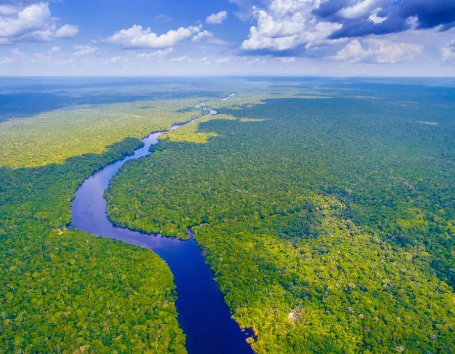
Meandering channels and their formation
Meandering channels are characterized by a series of curves and bends that form as a result of erosion and deposition processes. As water flows around a bend, it erodes the outer bank and deposits sediment on the inner bank, creating a meander.
Braided channels and their formation
Braided channels consist of multiple, interconnected channels separated by temporary islands called bars. These channels form in areas with a high sediment supply and variable water discharge, causing frequent changes in channel patterns.
River Deltas: A Special Case of River Formation
Types of river deltas
River deltas are areas where rivers deposit sediment as they enter a larger body of water, such as an ocean or lake. There are several types of deltas, including arcuate (fan-shaped), bird’s-foot (with multiple distributaries extending into the sea), and cuspate (V-shaped).
Processes leading to delta formation
Deltas form as a result of sediment deposition at the mouth of a river. The balance between sediment deposition and removal by waves, tides, and currents determines the shape and size of a delta.
Ecological significance of deltas
Deltas are rich in nutrients and provide diverse habitats for a variety of plant and animal species. They also serve as important breeding grounds for fish and nesting sites for migratory birds.
River Terraces: A Story of Changing Landscapes
The formation of river terraces
River terraces are flat, elevated surfaces found along the sides of a river valley. They form when a river cuts downward into its valley, leaving behind a series of abandoned floodplains at different elevations.
The Role of Tectonics and climate change in terrace formation
Tectonic forces and climate change can influence the formation of river terraces by affecting river discharge, sediment supply, and the rate of erosion.
Human Impact on River Formation and Evolution
Effects of Urbanization on Rivers
Urbanization can significantly impact rivers by altering their flow patterns, increasing pollution, and causing habitat fragmentation. Impervious surfaces, such as roads and buildings, can increase runoff and reduce the infiltration of water into the ground, leading to higher river discharge and an increased risk of flooding.
River engineering: dams, levees, and channelization
Human activities, such as the construction of dams, levees, and channelization, can alter the natural processes of river formation and evolution. These engineering projects can change the flow of rivers, disrupt sediment transport, and negatively affect aquatic ecosystems.

Climate change and its impact on river formation
Climate change can affect river formation by altering precipitation patterns, increasing evaporation, and causing more frequent and severe floods and droughts. These changes can lead to alterations in river flow, sediment transport, and the formation of various river features.
River Age: Stages and Characteristics
Rivers can be classified into different stages based on their age and the features they exhibit. Understanding the age of a river can provide insight into its geological history, as well as the processes that have shaped its course and landscape over time.
Youthful Rivers
Youthful rivers are typically found in the early stages of their development, characterized by steep gradients and a V-shaped valley profile. These rivers flow quickly, with a high capacity for erosion, and often form features such as rapids and waterfalls. Youthful rivers are generally found in mountainous regions where tectonic uplift or glacial activity has recently occurred.
Mature Rivers
As rivers age, they enter the mature stage, during which their channels and valleys evolve. Mature rivers have a lower gradient compared to youthful rivers, which leads to a reduction in their erosive power. These rivers exhibit a more sinuous, meandering pattern and develop features such as floodplains and oxbow lakes. The valleys of mature rivers are wider and have a U-shaped profile, reflecting the balance between erosion and deposition processes.
Old Rivers
Old rivers are those that have reached the final stage of their development, characterized by an even lower gradient and minimal erosive power. These rivers often flow through broad, flat plains and have highly meandering or braided channels. Old rivers exhibit extensive floodplains, with large deposits of sediment forming features such as deltas and alluvial fans. At this stage, the river’s energy is primarily focused on lateral erosion and deposition, shaping the surrounding landscape rather than cutting deeper into the valley.
In summary, the age of a river can be determined by examining its gradient, valley profile, and the features it exhibits. Each stage of a river’s development reflects the dynamic interplay of geology, precipitation, and erosion processes that shape our world’s watercourses.
Rivers can still form today
Rivers can still form today due to various natural processes and events. Some of the factors that contribute to the formation of new rivers include:
- Tectonic activity: Earthquakes, volcanic eruptions, and other tectonic events can alter the landscape, leading to the formation of new drainage paths and river systems. For example, a powerful earthquake might uplift a portion of land, causing water to flow in a new direction and create a river.
- Glacial retreat: As glaciers melt and recede, they can leave behind new valleys and depressions that become pathways for water flow. These meltwater streams may eventually develop into rivers, especially in areas where the glacial retreat exposes previously unconnected drainage basins.
- Human intervention: Although not a natural process, human activities like dam construction, land reclamation, or canal digging can sometimes create new river channels or alter existing ones. These artificial waterways may eventually evolve into natural rivers over time.
- Climate change: Changes in climate can lead to alterations in precipitation patterns, causing an increase in rainfall in some areas and leading to the formation of new river systems. Additionally, climate change can lead to the melting of ice caps and permafrost, which can release water into previously dry areas, creating new rivers.
While the formation of new rivers is relatively rare compared to the long geological history of the Earth, it is still an ongoing process influenced by various natural and human-induced factors.
Case Studies: Examining Iconic Rivers Around the World
The Amazon River: a study of Biodiversity and Hydrology
The Amazon River is the largest river system in the world by discharge and is known for its exceptional biodiversity. Its formation and hydrology are heavily influenced by the Andes Mountains, which provide both water and sediment to the river system. The Amazon’s complex network of tributaries and channels supports a vast array of plant and animal species, many of which are found nowhere else on Earth.
The Nile River: a cradle of Civilization
The Nile River has been an essential part of human civilization for thousands of years, providing water for agriculture, transportation, and other aspects of life in ancient Egypt. The Nile’s unique hydrology, characterized by annual floods, allowed for the development of early agriculture and the rise of one of the world’s first great civilizations. The formation and flow of the Nile are influenced by factors such as regional geology, precipitation patterns, and the interaction between the river and surrounding landscapes.
The Mississippi River: a tale of Engineering and environmental impact
The Mississippi River is one of the longest and most iconic rivers in North America. Human activity, including river engineering projects such as dams, levees, and channelization, has significantly impacted Mississippi’s natural processes and ecosystems. These projects have altered the river’s flow, disrupted sediment transport, and led to widespread environmental degradation, including the loss of wetlands and the creation of a vast “dead zone” in the Gulf of Mexico.
Conclusion
The dynamic nature of river formation is influenced by a complex interplay of factors, including geology, precipitation, erosion, and sediment transport. Understanding these processes is vital for sustainable development and the conservation of vital ecosystems. Rivers are not only essential for human civilization but also serve as critical habitats for a diverse array of plant and animal species.
Frequently Asked Questions (FAQs)
How do rivers maintain their flow?
Rivers maintain their flow through a combination of precipitation, surface runoff, and groundwater discharge. These sources replenish the water in a river and ensure a continuous flow.
How are waterfalls related to river formation?
Waterfalls are features that form when a river flows over a steep drop or a layer of resistant rock, causing the water to fall vertically. They are an example of how the underlying geology can influence river formation and the development of various river features.
Can a river change its course over time?
Yes, rivers can change their course over time due to factors such as erosion, sediment deposition, tectonic forces, and human activity. These changes can result in the formation of new channels, the abandonment of old ones, or alterations in the river’s overall path.
How do rivers contribute to the formation of landscapes?
Rivers play a significant role in shaping landscapes through processes such as erosion, sediment transport, and deposition. They can carve out valleys, create floodplains, and form various features such as waterfalls, meanders, and deltas.
How does human activity affect the natural process of river formation?
Human activities, such as urbanization, river engineering projects, and climate change, can have significant impacts on the natural processes of river formation. These activities can alter river flow, disrupt sediment transport, and cause habitat fragmentation, leading to changes in the formation and evolution of river features and ecosystems.
What is the oldest known river?
One of the contenders for the title of the oldest known river is the Finke River in central Australia.
The Finke River is believed to be around 300-340 million years old, based on geological evidence and the age of the surrounding landscapes. The river’s antiquity is attributed to the relatively stable tectonic environment of the Australian continent, which has allowed the river to persist over such an extended period.
Other ancient rivers include the Susquehanna River in the United States and the Nile River in Africa, though they are younger than the Finke River.
What is the youngest known river?
Some examples of relatively young rivers include those formed by glacial retreats, volcanic activity, or tectonic events.
One example of a relatively young river is the Toutle River in Washington State, USA, which was dramatically altered by the eruption of Mount St. Helens in 1980. The volcanic eruption caused massive mudflows, which created new river channels and significantly changed the course of the Toutle River.
Another example is the Jökulsá á Fjöllum in Iceland, which is a glacial river originating from the Vatnajökull ice cap. Given Iceland’s geologically young age (approximately 20 million years old) and the ongoing volcanic and glacial activity on the island, rivers like Jökulsá á Fjöllum can be considered relatively young.
Table of important terms used in the article
| Term or Concept | Definition or Description | Key Factors or Processes | Importance for Understanding River Formation |
|---|---|---|---|
| Watershed | An area of land that drains all the streams and rainfall to a common outlet, such as a river or lake | Precipitation, topography, land use | Defines the catchment area of a river system |
| River Channel | The natural or artificial path through which water flows, typically within the banks of a river | Erosion, deposition, river flow | Shapes the course and flow of the river |
| Groundwater | Water stored beneath the Earth’s surface in soil and rock formations, including aquifers | Precipitation, infiltration, geology | Contributes to river flow and maintenance |
| Meandering River | A winding, sinuous river channel pattern, typically found in mature rivers with low gradients | Erosion, deposition, river flow | Indicates the age and stage of river development |
| River Gradient | The slope or steepness of a river, generally measured as the change in elevation over a given distance | Topography, geology, tectonic forces | Influences the river’s flow, erosive power, and sediment transport |
| Floodplain | A flat area of land adjacent to a river, formed by the accumulation of sediment during periods of flooding | River flow, sediment deposition | Provides habitat and resources for ecosystems, helps regulate river discharge |
| Delta | A landform formed by the deposition of sediment at the mouth of a river, where it meets a larger body of water | River flow, sediment deposition, tidal action | Shows the interaction between river systems and larger bodies of water |
| River Capture (Piracy) | The process by which the headwaters of one river are diverted into another due to erosion or tectonic activity | Erosion, tectonic activity, river gradient | Explains how river networks can change over time |
| Oxbow Lake | A crescent-shaped lake formed when a meander of a river is cut off from the main channel due to erosion and deposition | Erosion, deposition, river flow | Demonstrates the dynamic nature of river channels |
| Alluvial Fan | A fan-shaped deposit of sediment that forms when a river’s velocity decreases as it flows onto flatter land | River flow, sediment deposition, topography | Highlights the role of sediment transport in river systems |
| Rapids | A section of a river where the water flows quickly and turbulently over a rocky, shallow riverbed | River flow, river gradient, geology | Indicates areas of high energy and erosive potential in river systems |
| River Rejuvenation | The process by which a river increases its erosive power due to tectonic uplift or a drop in sea level, leading to the formation of new landforms | Tectonic activity, sea level changes, river flow | Helps understand the impact of external factors on river systems |